


Republican Township Voting District, Clay County, Kansas
About
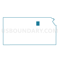
Outline

Summary
| Unique Area Identifier | 584255 |
| Name | Republican Township Voting District |
| County | Clay County |
| State | Kansas |
| Area (square miles) | 32.40 |
| Land Area (square miles) | 29.19 |
| Water Area (square miles) | 3.20 |
| % of Land Area | 90.11 |
| % of Water Area | 9.89 |
| Latitude of the Internal Point | 39.18424020 |
| Longtitude of the Internal Point | -97.01212670 |
Maps


Graphs
Select a template below for downloading or customizing gragh for Republican Township Voting District, Clay County, Kansas


Neighbors
Neighoring Voting District (by Name) Neighboring Voting District on the Map
- Fragrant Hill Township Voting District, Dickinson County, KS
- Gill Township Voting District, Clay County, KS
- Grant Township Voting District, Clay County, KS
- Milford Township Voting District, Geary County, KS
- Smokey Hill Township Voting District, Geary County, KS
- Union Township Voting District, Clay County, KS
Top 10 Neighboring County Subdivision (by Population) Neighboring County Subdivision on the Map
- Smoky Hill township, Geary County, KS (6,531)
- Milford township, Geary County, KS (1,669)
- Republican township, Clay County, KS (1,142)
- Fragrant Hill township, Dickinson County, KS (289)
- Union township, Clay County, KS (156)
- Grant township, Clay County, KS (146)
- Gill township, Clay County, KS (128)
Top 10 Neighboring Place (by Population) Neighboring Place on the Map
Top 10 Neighboring Unified School District (by Population) Neighboring Unified School District on the Map
- Geary County Schools Unified School District 475, KS (41,928)
- Clay Center Unified School District 379, KS (8,219)
- Chapman Unified School District 473, KS (6,205)
Top 10 Neighboring State Legislative District Lower Chamber (by Population) Neighboring State Legislative District Lower Chamber on the Map
Top 10 Neighboring State Legislative District Upper Chamber (by Population) Neighboring State Legislative District Upper Chamber on the Map
- State Senate District 22, KS (95,140)
- State Senate District 35, KS (66,006)
- State Senate District 21, KS (61,803)
Top 10 Neighboring 111th Congressional District (by Population) Neighboring 111th Congressional District on the Map
Top 10 Neighboring Census Tract (by Population) Neighboring Census Tract on the Map
- Census Tract 8, Geary County, KS (6,034)
- Census Tract 841, Dickinson County, KS (4,058)
- Census Tract 4581, Clay County, KS (3,894)